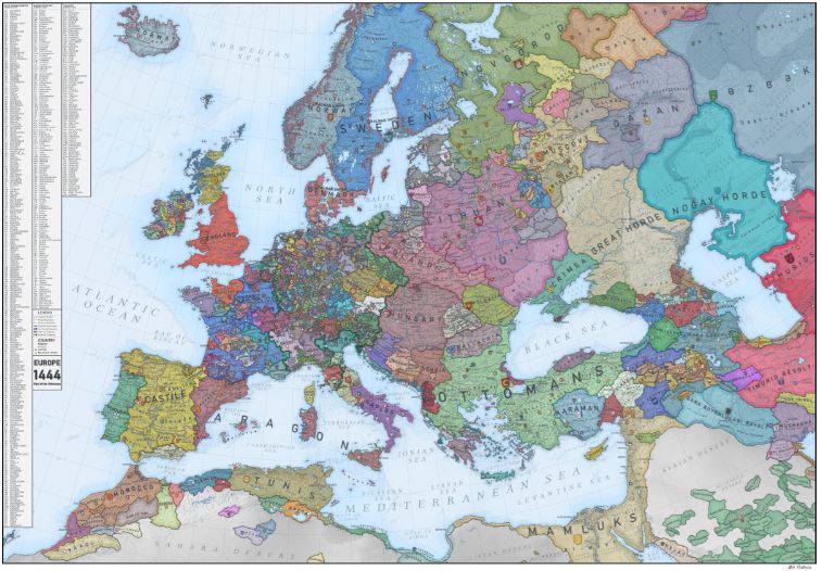
If you go to this link you’ll find a fascinating, zoomable map of Europe in 1444. You really can zoom right in, and my only regret is that more towns, etc. aren’t indicated. Well, a lot are listed by initials on the left, but it’s not the same as being able to read them once you’ve zoomed in close. Still, this map is definitely worth a look in order to “fix” places in the mind. It shows exactly how many small states there were jostling for position to the east of England/north of France. They’re like the jumbled pieces of a jigsaw puzzle in need of completion.

Leave a reply to tanya-salpe Cancel reply